|
New version of the the Australian Soil Classification released
The
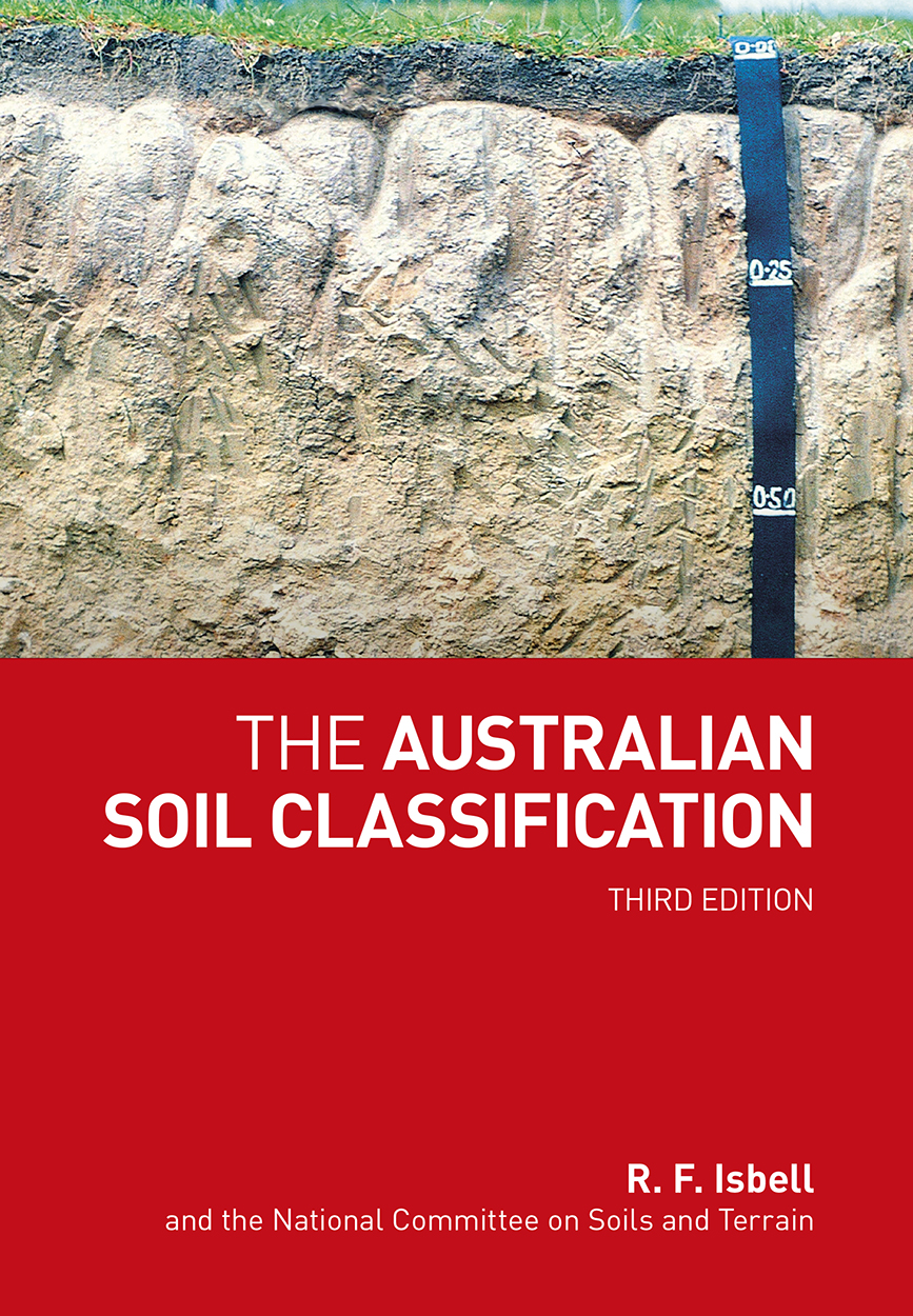
Third Edition of the Australian Soil Classification (Isbell
and NCST 2021) is now available from CSIRO
Publishing. The Australian Soil Classification provides a framework for organising knowledge about Australian soils by allocating soils to classes via a key. Since its publication in 1996, this book has been widely adopted and formally endorsed as the official national system. This new edition accommodates new knowledge and understanding of the significance, nature, distribution and refined testing for soils comprising deep sands, leading to the inclusion of a new Order, the Arenosols. |
|
Department of Agriculture and Water Resources funding supports legacy soil data capture
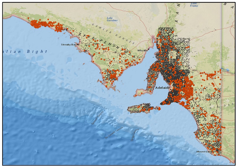
ACLEP has been working with state/territory agencies for many years to digitally capture, collate and disseminate soil data in a nationally consistent form. The Department of Agriculture and Water Resources provided $55,000 of National Landcare Programme funding through ACLEP to support the digitisation of some priority legacy data sets by states and for provision of that data to ASRIS. This included –
- South Australia – digital capture of approximately 650 soil site data particularly from non-farmed rangelands, Eyre and Yorke Peninsulas, Murraylands and the viticultural regions.
- Queensland – capture of soil mapping and associated data in the Desert Uplands, Haughton, Collinsville, Emerald and Burnett areas.
This project has supported the capture of locally and regionally significant soil data sets which can be used to underpin land development and management decisions related to agriculture, rangelands and mining interests amongst other purposes.
Download the report. |
|
New version of the the Australian Soil Classification released
The
Second Edition of the Australian Soil Classification (Isbell
and NCST 2016) is now available from CSIRO
Publishing. It includes updates from the National Committee on Soil and Terrain (NCST), especially in regards to new knowledge about acid sulfate soils (sulfidic materials). Modifications include
expanding the classification to incorporate different kinds of sulfidic
materials, the introduction of subaqueous soils as well as new Vertosol
subgroups, new Hydrosol family criteria and the consistent use of the
term reticulate. All soil orders except for Ferrosols and Sodosols are
affected by the changes. |
|
Proceedings of Soil Change Matters 2014 now available online
Read the papers and check out the photos from this highly successful workshop in Bendigo last year.
IOP Conference Series: Earth and Environmental Science Volume 25 (2015)
|
|
Science can drive the sustainability of our precious soils, water and oceans
After extensive consultation with industry and researchers, led by the Chief Scientist, the Australian Government has developed a set of nine Science and Research Priorities including one on ‘Soil and Water’. The rationale for the latter is outlined in recent contributions to The Conversation. |
|
New version of SoilMapp for iPad released
The new version of SoilMapp (v1.2) is now available for download. This version is designed for use with IOS 8.
Soil information at your fingertips. Find out what’s beneath your feet with CSIRO’s first app, SoilMapp, available from the Apple App Store. For more information visit www.csiro.au/soilmapp |
|
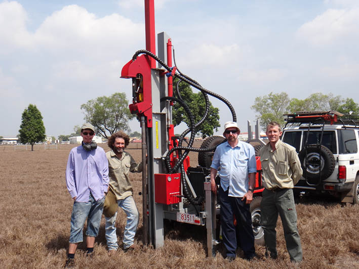
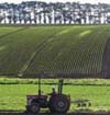
Soil Mapping in the Territory Just Got More Serious!
The Northern Territory Government, Land Assessment Unit has recently purchased a new soil sampling rig. The rig is a trailer based set up for remote area work with a 26hp diesel engine to assist the penetration of hard setting clay soils, fitted with dual spare tyres and 60L of diesel. When working in remote areas for long periods an entire field vehicle is usually dedicated for equipment, food and water, and camping gear so the trailor based setup enables the rig to be used when required, while not needing an additional dedicated vehicle in the field. This significant investment in new equipment will improve the quality of soil data, reduce time spent on site and enable deeper depths to be described and sampled. Further trialling of the new rig will take place over the 2013/14 wet season before it makes its maiden field trip in the 2014 dry season.
Click on the photo to get a better look at the new rig. |
|
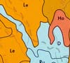
Land Resources of the Victoria River District - Report Released
The largest land, soil and vegetation survey undertaken in the Northern Territory, Land Resources of the Victoria River District, has been published in a package of information for landholders, industry, land managers and the general public. The report describes 230 land units based on lithology, and to national standard landform, soil and vegetation across a survey area of 75,000km2.
The report, and standard map products for one of the pastoral leases can be downloaded by clicking here |
|
20th World Congress of Soil Science
The 20th World Congress of Soil Science is to be held in Jeju Korea, June 8-13, 2014.
Call for Abstracts now open, deadline for submission October 31, 2013
Registrations are now open, early bird discounts close March 20, 2014
For more information visit: www.20wcss.org |
 |
A new Global Scientific Authority on Soils
The First Plenary of the Global Soil Partnership was held recently at the FAO Headquarters in Rome. Read more
Some of the key outcomes -
- The Intergovernmental Technical Panel on Soils (ITPS) will provide oversight for each Pillar.
- There will be a Draft Plan of Action for each Pillar and this will be prepared by a representative working group appointed by the ITPS.
- The ITPS will consider each Plan of Action and make recommendations to the GSP Plenary (the ultimate decision making authority) on the implementation of these Plans of Action.
- There will be a much clearer pathway for funding and supporting this work, through the Healthy Soils Trust Fund which was also approved.
|
 |
Global Soil Week 27-31 October 2013
The 2nd global Soil Week "Losing Ground", 27-31 October 2013, Berlin, Germany.
Conservative estimates state that we are losing 24 billion tons of fertile soil each year. What does “losing ground” imply for food, water and energy security? How do we manage soils for this nexus and what are the pathways towards more sustainable soil management? What are the triggers for change? The Global Soil Week 2013 “Losing Ground?” seeks to address these questions.
For further information visit: http://globalsoilweek.org/ |
 |
Let's Talk About Soil
This animated film tells the reality of soil resources around the world, covering the issues of degradation, urbanization, land grabbing and overexploitation; the film offers options to make the way we manage our soils more sustainable.
To watch the Let's Talk About Soil animated film click here |
 |
Position Vacant - Lecturer in Soil and Landscape Science
The Fenner School of Environment and Society (Australian National University) is advertising for a Lecturer in Soil and Landscape Science.
For more information visit http://jobs.anu.edu.au/PositionDetail.aspx?p=3382 |
 |
SoilMapp for iPad
Soil information at your fingertips. Find out what’s beneath your feet with CSIRO’s first app, SoilMapp, available from the Apple App Store.
For more information visit www.csiro.au/soilmapp |
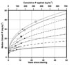 |
Strategic framework to improve phosphorus management in the Australian grains industry
This report provides a review of key phosphorus management issues on-farm in the Australian grains industry and develops a strategic framework to respond to these issues and improve efficiency, profits and sustainability.
Download the report. |
 |
Joint ASSSI and NZSSS soil Science Conference 2-7 December 2012
The 5th Joint SSA and NZSSS Soil Science Conference is being held in Tasmania between 2-7 December 2012. Over 300 delegates from throughout Australasia are expected to attend, including researchers, analysts, educationists, advisors, extension agents, land managers and policy makers from national, state and local government, universities and the private sector. The conference theme Soil Solutions for Diverse Landscapes reflects the breadth of soils, landforms and climate across the region, and the corresponding breadth of land use; from agriculture to forestry, conservation, recreation and urban use.
Visit www.soilscience2012.com for more information on the conference program, registration and tours. |
 |
TERN Soil and Landscape Facility
The Soil and Landscape Grid of Australia Facility will produce a comprehensive fine-resolution grid of soil attributes and important land surface parameters.
The facility, led by CSIRO will establish interactions with a broad range of collaborators from government, state departments and universities to develop the soil landscape grid infrastructure for Australia. The aims are to produce a coherent set of fine spatial resolution soil property maps with estimates of uncertainty that, integrated with modelling, might help provide ecosystem services to help device solutions to current concerns over food, water and energy securities, climate change and land degradation. |
 |
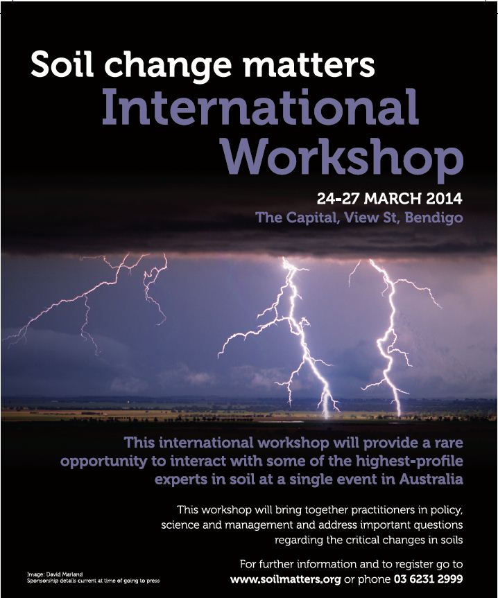
Soil Changes Matters - International Workshop 24-27 March 2014
Soil change in response to land use, land management and
climate. Understanding the mechanism and rate of change in
fundamental soil properties, and their extent across the
landscape, is critical for management of soil and land to ensure
enduring productivity and provision of ecosystem services.
The Soil Change Matters workshop is to be held in Bendigo, Victoria in March 2014. It is a joint meeting of the IUSS Global Soil Change and Soil Monitoring Working Groups and is hosted by DPI Victoria's 'Understanding Soil and Farming Systems' project. for more information visit www.dpi.vic.gov.au/vro/usfs |
 |
State of Environment 2011 – Land Chapter
The fourth national assessment of the state of Australia’s environment was launched on the 12th December 2011 by the Minister, the Hon Tony Burke MP. The report includes graded ‘report-card’ style assessments of environment condition and trends, pressures and management effectiveness.
The Land Chapter includes key findings for soil and land – with the situation and outlook mixed. Although we have made progress in many aspects of managing Australia's land environment, the trends for many indicators of land environmental values remain adverse, and are likely to be exacerbated by climate change. |
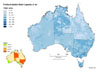 |
National Soil Grids released on ASRIS
The ASRIS team has produced a first set of gridded (250m) standard national soil data products for specific soil attributes. This inital release includes grids of clay content (0-30cm), bulk density (0-30cm) and plant available water capacity (0-1m).
Visit the National Soil Grids theme page for more information. |
 |
Soil policy update
The Soil Task Group has undertaken an assessment of current investment and capability in soils research, development and extension (RD&E) to assist in research and development collaboration including linkages of extension programs. For more information on this assessment and other soil policy activities of the National Committee on Soil and Terrain click here.
To view archived soil policy news items click here. |
 |
The Australian Soil Classification - An Interactive Key
Available as free download
The Australian Soil Classification - An Interactive Key allocates
soil profiles to every level within the official Australian
Soil Classification (revised edition).
The Australian Soil Classification - An Interactive
Key is available as a free download (100MB). The Open Delta software (Version 1.0) that runs the Interactive Key is available as a free download. The Interactive Key is compatible with Windows 8 and earlier windows versions. |
 |
ASRIS/ACLEP User Needs Analysis
This report documents a project to assess ‘existing needs’ of key users of the Australian Soil Resources Information System (ASRIS). The project was not an exhaustive evaluation of all users’ requirements nor was it a technical review of the ASRIS delivery mechanism.
ACLEP commissioned this report to provide direction for the future development of national soil data products that would meet specific user requirements and be applicable to a broad range of soil data users. In particular, to identify the attributes of soil that would be most relevant to specific needs. Download the report. |
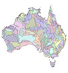 |
Physiographic Regions of Australia
The report gives an overview of physiographic mapping in Australia, describes current methods for mapping and provides a brief description of Australia’s landscapes and the regions that have been defined. The audience will range from those who are looking for a brief description of the physiography of Australia to those who will use the data for integrated studies of the environment.
The report and digital data set are available for download from the Australian Soil Resource Information System. |
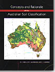 |
Concepts and Rationale of the Australian Soil Classification - back in print
This publication which was out of print is once again available from CSIRO publishing. It is designed to be read in conjunction with The Australian Soil Classification by R.F. Isbell. It elaborates on many of the diagnostic horizons and materials given in the glossary of the classification, and gives the rationale for the establishment of various classes and diagnostic criteria. The book also gives an overview of the general features of the new orders with individual distribution maps showing their occurrence in Australia. |
 |
CSIRO Land Research Series
The CSIRO Land Research Series are available as electronic downloads from the CSIRO Publishing website. An abstract and PDF text file of each report are provided and raster copies of maps as JPG files are included. Vector copies of some maps are available from other Commonwealth and State agencies and access details are provided where appropriate.
Visit the CSIRO Land Research Series website |