 ASRIS (Australian
Soil Resource Information System) The Australian Soil Classification Online (2nd Ed.)
 Handbooks
Volume 1 - Field Handbook
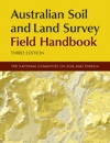 The Field Handbook (commonly known as the ‘Yellow Book’) is an essential resource for soil scientists, ecologists, geomorphologists, educators and students and has enjoyed remarkable success as part of the popular Australian Soil and Land Survey Handbook Series which covers all aspects of land resource survey in Australia.
The latest edition includes revised chapters on location and vegetation as well as some new landform elements.
The Field Handbook specifies methods and terminology for soil and land surveys and is widely used throughout Australia, providing the reference set of definitions for the characterisation of landform, vegetation, land surface, soil and substrate.
Australian Soil and Land Survey Field Handbook (3rd Edition) is now available from CSIRO Publishing.
Volume 2 - Guidelines for Surveying Soil and Land Resources
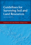 Guidelines for Surveying Soil and Land Resources (2nd edition) promotes the development and implementation of consistent methods and standards for conducting soil and land resource surveys in Australia. These surveys are primarily field operations that aim to identify, describe, map and evaluate the various kinds of soil or land resources in specific areas.
The advent of geographic information systems, global positioning systems, airborne gamma radiometric remote sensing, digital terrain analysis, simulation modelling, efficient statistical analysis and internet-based delivery of information has dramatically changed the scene in the past two decades. As successor to the Australian Soil and Land Survey Handbook: Guidelines for Conducting Surveys, this authoritative guide incorporates these new methods and techniques for supporting natural resource management.
Soil and land resource surveyors, engineering and environmental consultants, commissioners of surveys and funding agencies will benefit from the practical information provided on how best to use the new technologies that have been developed, as will professionals in the spatial sciences such as geomorphology, ecology and hydrology.
Guidelines for Surveying Soil and Land Resources (2nd edition) from the Australian Soil and Land Survey Handbooks Series is available from CSIRO Publishing.
Volume 3 - Soil Chemical Methods - Australasia
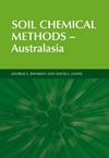
Soil Chemical Methods – Australasia describes over 200 laboratory and field chemical tests relevant to Australasia and beyond. The information and methodology provided across 20 chapters is comprehensive, systematic, uniquely coded, up-to-date and designed to promote chemical measurement quality. There is guidance on the choice and application of analytical methods from soil sampling through to the reporting of results. In many cases, optional analytical ‘finishes’ are provided, such as flow-injection analysis, electro-chemistry, multiple flame technologies, and alternatives to chemical testing offered by near-range and mid-range infrared diffuse reflectance spectroscopy.
The book supersedes and updates the soil chemical testing section of the 1992 Australian Laboratory Handbook of Soil and Water Chemical Methods of Rayment and Higginson, while retaining method codes and other strengths of that Handbook. Chapters cover soil sampling, sample preparation and moisture content; electrical conductivity and redox potential; soil pH; chloride; carbon; nitrogen; phosphorus; sulphur; gypsum; micronutrients; extractable iron, aluminium and silicon; saturation extracts; ion-exchange properties; lime requirements; total miscellaneous elements; miscellaneous extractable elements; alkaline earth carbonates and acid sulfate soils. In addition, there are informative Appendices, including information on the accuracy and precision of selected methods.
Soil Chemical Methods – Australasia is available from CSIRO Publishing.
Volume 4 - The Australian Soil Classification
 The Australian Soil Classification serves as a framework for organising
knowledge about Australian soils and provides a means of communication
amongst scientists and those who use the land. It is useful for
those involved in environmental studies and for teachers of soil
science. The Australian Soil Conservation Council formally endorsed
the classification in 1992 and recommended its adoption by all States
and Territories and its use in all future Federally funded land
resource inventory and research programs.
The Revised Edition of the Australian Soil Classification was published in 2002 and is available from CSIRO Publishing.
The Australian Soil Classification - An Interactive Key
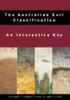 The Australian Soil Classification - An Interactive Key allocates
soil profiles to every level within the official Australian
Soil Classification (revised edition). The Interactive Key is available as a free download (installation instructions included). The Open Delta software that runs the Interactive Key is compatible with Windows 7 and earlier windows versions.
Concepts and Rationale of the Australian Soil Classification
The Concepts and Rationale of The Australian Soil Classification is a publication designed to be read in conjunction with the The Australian Soil Classification. It elaborates on many of the diagnostic horizons and materials given in the glossary of the classification and gives the rationale for the establishment of various classes and diagnostic criteria. The book also gives an overview of the general features of the new orders with individual distribution maps showing their occurrence in Australia.
The Concepts and Rationale of The Australian Soil Classification is available CSIRO Publishing.
Volume 5 - Soil Physical Measurement and Interpretation for Land Evaluation
 Soil physical measurements are essential for solving
many natural resource management problems. This operational laboratory
and field handbook provides, for the first time, a standard set
of methods that are cost-effective and well suited to land resource
survey.
Volume 5 provides:
- practical guidelines on the soil physical measurements across a range of soils, climates and land uses;
- straightforward descriptions for each method (including common pitfalls) that can be applied by people with a rudimentary knowledge of soil physics, and
- guidelines on the interpretation of results and integration with land resource assessment.
Soil Physical Measurement And Interpretation for Land Evaluation begins with an introduction to land evaluation and then outlines procedures for field sampling. Twenty detailed chapters cover pore space relations, water retention, hydraulic conductivity, water table depth, dispersion, aggregation, particle size, shrinkage, Atterburg limits and strength. The book includes procedures for estimating soil physical properties from more readily available data and shows how soil physical data can be integrated into land planning and management decisions.
This publication is available from CSIRO Publishing.