 ASRIS (Australian
Soil Resource Information System) The Australian Soil Classification Online (2nd Ed.)
 Other publications
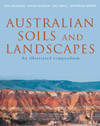
Australian Soils and Landscapes:
An Illustrated
Compendium
 This
essential reference provides an introduction to the remarkable
soils and landscapes of Australia. It reveals their great diversity
and explains why an understanding of soil properties and landscape
processes should guide our use of the land.
Using striking photographs of characteristic landscapes, it begins by describing the basic properties of soils and how Australia's distinctive soils and landscapes have co-evolved. We gain a greater understanding of why particular soils occur at certain locations and how soil variation can influence landscape processes, agricultural productivity and ecosystem function. The book explains the impact of various forms of land use and the changes they can bring about in soil.
This is followed by an invaluable compendium that describes and illustrates over 100 of the more important and widespread soils of Australia, along with their associated landscapes. There is a brief account of each soil's environment, usage and qualities as well as details on chemical and physical properties so we can make more informed decisions about appropriate land-use.
Australian Soils and Landscapes (McKenzie, Jacquier, Isbell and Brown 2004) will be a valuable resource for farmers, natural resource managers, soil and environmental scientists, students and anyone with an interest in Australia's unique environment.
Australian Soils and Landscapes: an illustrated compendium is available from CSIRO Publishing.
Proximal Soil Sensing
 This book reports on developments in Proximal Soil Sensing (PSS) and high resolution digital soil mapping. PSS has become a multidisciplinary area of study that aims to develop field-based techniques for collecting information on the soil from close by, or within, the soil. Amongst others, PSS involves the use of optical, geophysical, electrochemical, mathematical and statistical methods. This book is suitable for undergraduate course material and postgraduate research, brings together ideas and examples from those developing and using proximal sensors and high resolution digital soil maps for applications such as precision agriculture, soil contamination, archaeology, peri-urban design and high land-value applications, where there is a particular need for high spatial resolution information. The book in particular covers soil sensor sampling, proximal soil sensor development and use, sensor calibrations, prediction methods for large data sets, applications of proximal soil sensing, and high-resolution digital soil mapping.
Proximal Soil Sensing is available from Springer.
Field Guide for Describing Regolith and Landforms
 The use of standard terminology for the characterisation of site attributes, such as landform and vegetation, and for the description of regolith has obvious benefits for the various organisations in Australia concerned with regolith investigations. Some uniformity in the description of regolith has been achieved over the years with the publication of RTMAP Regolith Database Field Book and Users Guide (Pain et al. 1991, 2007), Regolith landform mapping in the Yilgarn Craton, Western Australia: towards a standardised approach (Craig et al. 1999) and Genesis, classification and atlas of ferruginous materials, Yilgarn Craton (Anand et al. 2002). Because there are a number of possible approaches (for example, in setting class limits) for many attributes, the classes adopted here are taken, where possible, from Australian standards—and in particular The Australian Soil and Land Survey Field Handbook (McDonald et al. 1990, NCST 2008), which is considered to be most appropriate for Australian conditions.
This Guide is based largely on the field component of Pain et al. (2007). It covers a range of field observations that are convenient to measure or observe, and are relevant both to practical problems of mineral exploration and natural resource management, and the scientific study of regolith. Improvements will depend to a degree on the use of more systematic methods in the recording of field observations, in order to test the underlying, often un-stated models that often guide the recording of such observations. It is hoped that the use of this Guide will allow the development of more concise, or more relevant, field observations than those recommended in it. Improvements will come only from knowledge of the precise needs of clients.
Field Guide for Describing Regolith and Landforms (PDF - 3.2MB ) is available from CRC Landscape Environments and Mineral Exploration.
The Soils of Southern South Australia
 This 446 page, full-colour, South Australian Dept of Water, Land & Biodiversity Conservation (DWLBC) publication describes the soil resources of SA’s productive and diverse temperate zone (commonly known as the ‘agricultural areas’), summarising concepts and data specifically relating to soil type. In particular, the nature, diversity, distribution, limitations and potential of these resources are described. The book is part-documentation of the knowledge and information developed via the SA Land & Soil Mapping Program—which has been underway since the 1980s.
Soils are organised into 15 Soil Groups and 61 subgroup soils based on features of most importance to land use and management. There are 15 chapters in the main part of the book—one for each Soil Group—which include maps, data, images and standardised 2-page presentations of constituent subgroup soils (highlighting, for example, drainage, waterholding capacity, erodibility and potential for irrigation).
The book retails for $99 (plus postage), and can be obtained from the PIRSA Customer Service Centre (Ph 08 8463 3000;
Email pirsa.customerservices@sa.gov.au).