Ferrosols [FE]
Concept
Soils with B2 horizons which are high in free iron oxide, and which lack strong texture contrast between A and B horizons.
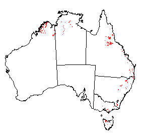
Distribution of Ferrosols in Australia.
Soil Profile (View type example photo
of Red Ferrosol).
Definition
Soils other than Vertosols, Hydrosols, and Calcarosols that:
- Have B2 horizons in which the major part has a free iron oxide free iron oxide1 content greater than 5% Fe in the fine earth fraction (<2 mm), and
- Do not have clear or abrupt textural B horizons or a B2 horizon in which at least 0.3m has vertic properties.
Comment
These soils are almost entirely formed on either basic or ultrabasic igneous rocks, their metamorphic equivalents, or alluvium derived therefrom. Although these soils do not occupy large areas in Australia, they are widely recognised and often intensively used because of their favourable physical properties. The most common forms have B2 horizons with strong polyhedral compound peds up to 10-15 mm, usually with smooth and often shiny faces. These break down readily to primary peds about 5 mm or less in size. However forms also occur with a very fine granular structure which may appear massive in place.
Suborders
- The dominant colour class in the major part of the upper 0.5 m of the B2 horizon (or the major part of the entire B2 horizon if it is less than 0.5 m thick) is red. Red [AA]
- The dominant colour class is brown. Brown [AB]
- The dominant colour class is yellow. Yellow [AC]
- The dominant colour class is grey. Grey [AD]
- The dominant colour class is black. Black [AE]
Great Groups
It is thought that the great group classes listed below will be appropriate for each colour suborder. Red and Brown are by far the most common colour classes. Of the great groups listed below, the Calcareous and Magnesic classes are relatively uncommon.
- Soils with an exchangeable Ca/Mg ratio of less than 0.1 in the major part of the B2 horizon. Magnesic [DB]
- Soils in which the major part of the B2 horizon is dystrophic. Dystrophic [AF]
- Soils in which the major part of the B2 horizon is mesotrophic. Mesotrophic [AG]
- Soils in which the major part of the B2 horizon is eutrophic but the B and BC horizons are not calcareous. Eutrophic [AH]
- Soils in which at least some part of the B or the BC horizon is calcareous. Calcareous [BC]
Subgroups
It is thought that the following subgroups will cater for most situations, although obviously some will not be relevant for particular great groups.
- Soils with an A horizon having a very fine granular structure (< 2 mm) and a dry consistence strength that is weak to very weak. The horizon usually has a low bulk density and may be water repellent. Snuffy [EN]
- Soils with a humose horizon and the major part of the B2 horizon is strongly acid. Humose-Acidic [GY]
- Other soils with a humose horizon. Humose [CK]
- Soils with a melacic horizon. Melacic [DG]
- Soils with a melanic horizon and the major part of the B2 horizon is mottled. Melanic-Mottled [DM]
- Soils with a melanic horizon and the major part of the B2 horizon is strongly acid. Melanic-Acidic [FV]
- Other soils with a melanic horizon. Melanic [DK]
- Soils with a ferric horizon within the solum and a B2 horizon in which the major part is strongly acid. Ferric-Acidic [GW]
- Other soils with a ferric horizon within the solum. Ferric [BU]
- Soils with a manganic horizon within the solum. Manganic [DC]
- Other soils with a B2 horizon in which the major part is strongly acid. Acidic [AI]
- Soils with a B horizon in which at least the lower part is sodic. Sodic [EO]
- Other soils in which the major part of the B2 horizon is mottled. Mottled [DQ]
- Other soils in which the major part of the B2 horizon is whole coloured. Haplic [CD]
Comment
The Haplic subgroup is the most common in the Ferrosols classified to date (55%), followed by Acidic at 15%, with the remaining subgroups fairly evenly distributed. All Haplic soils have been further examined, but apart from possibly using structure there seem to be few other differentiae that could be used for further subdivision.
Family Criteria
A1 horizon thickness
| Thin | [A] | : < 0.1 m |
|---|---|---|
| Medium | [B] | : 0.1 - < 0.3 m |
| Thick | [C] | : 0.3 - 0.6 m |
| Very thick | [D] | : > 0.6 m |
Gravel of the surface and A1 horizon
| Non-gravelly | [E] | : < 2% |
|---|---|---|
| Slightly gravelly | [F] | : 2 - < 10% |
| Gravelly | [G] | : 10 - < 20% |
| Moderately gravelly | [H] | : 20 - 50% |
| Very gravelly | [I] | : > 50% |
A1 horizon texture
| Peaty | [J] | : see Peaty horizon |
|---|---|---|
| Sandy | [K] | : S-LS-CS (up to 10% clay) |
| Loamy | [L] | : SL-L (10-20% clay) |
| Clay loamy | [M] | : SCL-CL (20-35% clay) |
| Silty | [N] | : ZL-ZCL (25-35% clay and silt 25% or more) |
| Clayey | [O] | : LC - MC - HC (greater than 35% clay) |
B horizon maximum texture2
| Clay loamy | [M] | : SCL-CL (20-35% clay) |
|---|---|---|
| Silty | [N] | : ZL-ZCL (25-35% clay and silt 25% or more) |
| Clayey | [O] | : LC - MC - HC (greater than 35% clay) |
Soil depth
| Very shallow | [T] | : < 0.25 m |
|---|---|---|
| Shallow | [U] | : 0.25 - < 0.5 m |
| Moderate | [V] | : 0.5 - < 1.0 m |
| Deep | [W] | : 1.0 - < 1.5 m |
| Very deep | [X] | : 1.5 - 5 m |
| Giant | [Y] | : > 5 m |
1 Citrate-dithionite extract (Rayment and Higginson 1992, Method 13C1.)
2 This refers to the most clayey field texture category.